
The Basin trails
Click on a trail to view its statistics, map and profile.
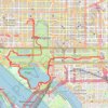
Washington DC's Monuments and Memorials Loop Walk
This loop walk offers a serene and reflective experience. Starting at the White House, you pass through the National Mall, observing landmarks such as the Washington Monument, World War II Memorial, and the Lincoln Memorial before circling the Tidal Basin to see memorials honoring Jefferson, Roosevelt, and…
Distance: 18.5 Km • Elevation gain: 191 m • Maximum elevation: 48 m
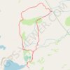
Wrights Lake and Enchanted Pools Loop
United States > California > El Dorado County
From the Wrights Lake trailhead area, this loop leaves the lakeshore through the inlet meadows and forest, joining the Twin Lakes Trail in the Eldorado National Forest and at the edge of Desolation Wilderness. It then heads toward the Enchanted Pools, where South Fork Silver Creek works through polished…
Distance: 6.4 Km • Elevation gain: 137 m • Maximum elevation: 2,229 m
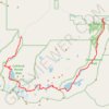
The Enchantments
United States > Washington > Chelan County
From the Stuart Lake Trail, the route enters the Alpine Lakes Wilderness through forest, creek crossings, and gradually rougher alpine terrain before reaching Colchuck Lake, a striking first landmark set below Colchuck Peak and Dragontail Peak, with Aasgard Pass rising steeply above the far shore as the…
Distance: 29.2 Km • Elevation gain: 1,502 m • Maximum elevation: 2,383 m
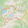
Chain Lakes Loop Trail
United States > Washington > Whatcom County
The Chain Lakes Loop Trail explores the dramatic alpine landscape of the Mount Baker–Snoqualmie National Forest, beginning here at Artist Point beneath the steep southern slopes of Table Mountain. The trail initially traverses open heather meadows and rocky terrain, with broad views toward Mount Baker, Mount…
Distance: 9.1 Km • Elevation gain: 601 m • Maximum elevation: 1,668 m
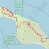
Trans Catalina Trail (TCT)
United States > California > Los Angeles County > Avalon > Pebbly Beach
The Trans-Catalina Trail begins in Avalon, leaving the island’s lively harbor town to climb into the dry, rugged interior of Santa Catalina Island. The route passes Haypress Reservoir and Cape Canyon Reservoir before entering the Black Jack backcountry and continuing toward Catalina Airport, often known as…
Distance: 62.3 Km • Elevation gain: 2,826 m • Maximum elevation: 531 m

Cecret Lake Trail via Upper Albion Meadows Trail in Uinta-Wasatch-Cache National Forest
United States > Utah > Salt Lake County > Alta
The hike to Cecret Lake via the Upper Albion Meadows Trail offers a peaceful journey through colorful wildflower meadows, leading to a serene alpine lake surrounded by striking rocky cliffs. As you ascend, you’ll be treated to views of Albion Basin, where vibrant summer wildflowers and the chance to spot…
Distance: 7.3 Km • Elevation gain: 364 m • Maximum elevation: 3,010 m

Desolation Wilderness 7 Summits Loop Hike
United States > California > El Dorado County
Starting from Glen Alpine Road near Fallen Leaf Lake, this demanding high-country loop enters the southern Desolation Wilderness beneath Angora Peak and sweeps south and west through granite terrain toward Ralston Peak. The climb gradually opens views across the Echo Lakes country, Fallen Leaf Lake and the…
Distance: 38.6 Km • Elevation gain: 2,956 m • Maximum elevation: 3,034 m

Mount Katahdin and Hamlin Peak Loop
United States > Maine > Piscataquis County > Mount Katahdin Township
Loop hike to Mount Katahdin and Hamlin Peak via Chimney Pond Trail, Helon Taylor Trail, Pamola, Knife Edge Trail, Chimney Peak, South Peak, Baxter Peak, Saddle Trail, Northwest Basin Trail, Caribou Spring, Hamlin Ridge Trail, Hamlin Peak, North Basin Trail, North Basin Cut-Off and Basin Ponds in the Baxter…
Distance: 16.2 Km • Elevation gain: 1,311 m • Maximum elevation: 1,586 m

Hemlock Falls Loop
United States > New Jersey > Essex County > Maplewood
Starting from the South Orange Avenue access, this loop enters South Mountain Reservation on the Crest Trail and follows a shaded woodland corridor before joining Openwood Trail and curving deeper into the forest. The route then uses Lenape Trail and the local Hemlock Falls Loop to reach Hemlock Falls on…
Distance: 2.6 Km • Elevation gain: 67 m • Maximum elevation: 163 m

Delicate Arch
United States > Utah > Grand County
Starting at the Delicate Arch Trailhead, the route leaves the parking area near Salt Wash and follows Delicate Arch Trail past the historic Wolfe Ranch area and the nearby Ute Indian petroglyph panel. From there, it heads into open desert terrain, crossing shallow drainages and moving away from the easier…
Distance: 5.1 Km • Elevation gain: 194 m • Maximum elevation: 1,469 m
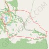
Naches Peak Loop
United States > Washington > Pierce County
Starting from the Tipsoo Lake area, the loop climbs toward Chinook Pass, crosses the highway footbridge, and joins the Pacific Crest Trail as it skirts the north and east side of Naches Peak through subalpine forest, open slopes, and small mountain ponds. The route then bends around the quieter eastern…
Distance: 5.4 Km • Elevation gain: 205 m • Maximum elevation: 1,793 m
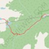
Crater Lakes via South Boulder Creek
United States > Colorado > Gilpin County > East Portal Distributed Camping Area
Starting at the Moffat Tunnel East Portal, the route enters Roosevelt National Forest and follows the South Boulder Creek Trail into the James Peak Wilderness, passing dense subalpine forest, creekside clearings, and the Forest Lakes Trail junction before turning onto the signed Crater Lakes Trail. The climb…
Distance: 11.0 Km • Elevation gain: 559 m • Maximum elevation: 3,364 m

Clouds Rest from Tenaya Lake
United States > California > Mariposa County
From the Sunrise Lakes Trailhead beside Tenaya Lake, the route leaves Tioga Road and moves quickly from the open lakeshore into lodgepole forest and granite slabs, following the southbound trail signed for Clouds Rest and Sunrise before climbing away from the basin above Tenaya Creek. Beyond the Sunrise Lakes…
Distance: 19.3 Km • Elevation gain: 881 m • Maximum elevation: 2,991 m

Big Pine Lakes Loop
United States > California > Inyo County
From the Glacier Lodge area, this Big Pine Lakes Loop begins along the North Fork Big Pine Creek Trail, entering the John Muir Wilderness of Inyo National Forest. The route climbs beside North Fork Big Pine Creek through forest and sagebrush slopes before reaching the higher canyon beneath Mount Alice. The…
Distance: 24.5 Km • Elevation gain: 1,235 m • Maximum elevation: 3,432 m
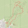
Brand Park Loop (Verdugo Mountains)
United States > California > Los Angeles County > Glendale
Starting near Brand Park, a foothill park at the base of the Verdugo Mountains, the loop leaves the landscaped edge of Glendale toward Brand Debris Basin, the Bamboo Ruins Trail, and the lower folds of Brand Canyon. The route then climbs Brand Motorway through chaparral-covered slopes and open switchbacks to…
Distance: 9.5 Km • Elevation gain: 790 m • Maximum elevation: 862 m

Hanging Lake
United States > Colorado > Garfield County
Starting beside the Colorado River in Glenwood Canyon, the route leaves the canyon floor and enters Dead Horse Creek Canyon, climbing into the White River National Forest. The ascent follows a shaded, rocky gorge with footbridges, creek crossings, switchbacks, rock steps, and fire-marked canyon scenery before…
Distance: 5.0 Km • Elevation gain: 378 m • Maximum elevation: 2,224 m
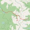
Lone Eagle Peak - Pawnee Pass
United States > Colorado > Grand County
From the Lake Granby side, this traverse begins near Monarch Lake and follows the Cascade Creek corridor into the Indian Peaks Wilderness, passing forested shoreline, Arapaho Pass Trail junction, Buchanan Creek, Cascade Creek, and waterfall-lined sections of the valley. Beyond the Cascade Creek basin, the…
Distance: 32.9 Km • Elevation gain: 2,006 m • Maximum elevation: 3,824 m
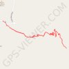
Lost Mine Trail in Big Bend National Park
United States > Texas > Brewster County > Chisos Mountains Basin Junction
The Lost Mine Trail offers a stunning, accessible hike that is packed with unforgettable views. The trail winds through diverse scenery, starting with a gradual ascent through forested areas before revealing breathtaking vistas over Juniper Canyon as you reach the saddle point. The final climb leads you…
Distance: 7.8 Km • Elevation gain: 367 m • Maximum elevation: 2,077 m
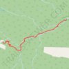
Ouzel Falls, Calypso Cascades and Copeland Falls via Wild Basin Trail
United States > Colorado > Boulder County
The Wild Basin Trail in Rocky Mountain National Park offers hikers a scenic journey through lush forests alongside the melodious North St. Vrain Creek. Early in the hike, visitors encounter the tranquil beauty of Copeland Falls, followed by the impressive Calypso Cascades, where water tumbles gracefully over a…
Distance: 9.2 Km • Elevation gain: 337 m • Maximum elevation: 2,868 m

Lone Pine Lake
United States > California > Inyo County
Starting at Whitney Portal, a wooded canyon at the end of Whitney Portal Road, the route follows the Mount Whitney Trail past the North Fork of Lone Pine Creek and into the John Muir Wilderness, with granite walls and the Mount Whitney massif framing the ascent. It then climbs through conifer forest on a…
Distance: 4.7 Km • Elevation gain: 549 m • Maximum elevation: 3,067 m

Indian Maiden Falls
United States > Arizona > Yavapai County
Beginning on the quiet uplands near Bald Hill, this route follows the upper West Clear Creek Trail across pinyon-juniper country toward the canyon rim before committing to the steep, loose descent through exposed slopes and a side drainage, with broad views into the deep gorge cut from the southern edge of the…
Distance: 6.5 Km • Elevation gain: 133 m • Maximum elevation: 1,762 m
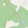
Avalanche Lake
United States > Montana > Flathead County
Starting from the Avalanche area, the route first follows the shaded Trail of the Cedars through old-growth cedar and hemlock forest beside Avalanche Creek, where the water has carved the narrow and lively passage of Avalanche Gorge. Beyond the gorge, the Avalanche Lake Trail leaves the boardwalk and climbs…
Distance: 9.5 Km • Elevation gain: 329 m • Maximum elevation: 1,219 m

Arch Rock and Heart Rock via Arch Rock Trail in Joshua Tree National Park
United States > California > Riverside County
The Arch Rock Trail in Joshua Tree National Park offers a brief but captivating hiking experience, taking visitors through a vast landscape of unique rock formations and desert terrain. Along the way, hikers encounter the renowned Arch Rock, a natural rock arch that stands as a striking feature of the park,…
Distance: 2.5 Km • Elevation gain: 34 m • Maximum elevation: 1,193 m
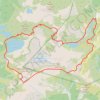
Chain Lakes and Wild Goose Trails Loop
United States > Washington > Whatcom County
From the Heather Meadows area, this loop first drops toward Bagley Dam and the open basin of Bagley Lakes, where Bagley Creek, subalpine meadows, heather, and the slopes of Table Mountain and Mount Herman shape the approach to the Chain Lakes Trail. The setting is one of the signature hiking areas of the upper…
Distance: 12.5 Km • Elevation gain: 623 m • Maximum elevation: 1,666 m
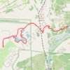
Five Lakes Loop
United States > California > Placer County > Alpine Meadows
Starting at the Five Lakes Trailhead near Alpine Meadows Road, the route follows the Five Lakes Trail away from the developed valley and climbs through open Sierra slopes, scattered conifers, and granite-studded terrain toward the edge of Tahoe National Forest. The path then enters the Granite Chief…
Distance: 9.9 Km • Elevation gain: 438 m • Maximum elevation: 2,317 m

Dripping Springs (Grand Canyon)
United States > Arizona > Coconino County
Starting at historic Hermits Rest, the route leaves the South Rim gateway to the Hermit Trail and descends from the viewpoint area onto steep canyon switchbacks through the upper limestone and sandstone layers, with widening views into the Grand Canyon. The trail then passes through Waldron Basin and reaches…
Distance: 5.2 Km • Elevation gain: 347 m • Maximum elevation: 2,030 m

Ramapo Valley County Reservation Loop Hike: Scarlet Oak Pond, Bald Mountain, Bear Swamp Lake, MacMillan Reservoir
United States > New Jersey > Bergen County > Mahwah > Darlington
Starting from the Darlington side of Ramapo Valley County Reservation, this loop follows Vista Spur Trail toward the Ramapo River before joining Pond Loop Trail beside Scarlet Oak Pond. The route soon leaves the water on Vista Loop, climbing through the forest to Hawk Rock and Cactus Ledge, where open rock…
Distance: 19.4 Km • Elevation gain: 524 m • Maximum elevation: 351 m
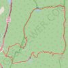
Mount Lafayette Loop
United States > New Hampshire > Grafton County > Lincoln
The Mount Lafayette Loop begins in Franconia Notch, at the edge of the White Mountain National Forest, and climbs away from the parkway into shaded hardwood and spruce forest. The route follows the Falling Waters side of the loop beside Walker Brook and Dry Brook, passing Stairs Falls and Cloudland Falls as…
Distance: 13.5 Km • Elevation gain: 1,138 m • Maximum elevation: 1,582 m
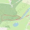
A walk around The Vyne
United Kingdom > England > Hampshire > Basingstoke and Deane > Sherborne St John > Smiths Green
Distance: 2.9 Km • Elevation gain: 29 m • Maximum elevation: 90 m
Lake Ingalls via Ingalls Way Trail and Ingalls Pass in Alpine Lakes Wilderness
United States > Washington > Kittitas County
The hike to Lake Ingalls offers an incredible adventure through the Alpine Lakes Wilderness, with expansive views of rugged peaks and serene alpine waters. From the trailhead, you will experience a steady climb, surrounded by dense forests and stunning vistas of the Esmerelda Peaks and Headlight Basin. Upon…
Distance: 14.1 Km • Elevation gain: 872 m • Maximum elevation: 1,986 m

Lindsey Lake to Five Lakes Basin Loop
United States > California > Nevada County
Loop hike between Lindsey Lake and Five Lakes Basin via Carr-Lindsey Road, Middle Lindsey Dam, Culbertson Lake, Lindsey Lake Trail, Lower Rock Lake, Rock Lake, Crooked Lake Trail, Penner Lake, Crooked Lakes, Island Lake, Round Lake Trail, Long Lake, Round Lake, Milk Lake, Grouse Ridge Trail, Sand Ridge Trail,…
Distance: 37.7 Km • Elevation gain: 1,044 m • Maximum elevation: 2,314 m

Kaaterskill Falls Trail and Viewing Platform in Kaaterskill Wild Forest
United States > New York > Greene County > Town of Hunter
The Kaaterskill Falls Trail offers a scenic journey through the lush forest of the Catskills, leading to breathtaking views of one of New York's tallest waterfalls. Hikers can enjoy multiple vantage points, including a well-maintained viewing platform, where the cascading water plunges dramatically into the…
Distance: 2.6 Km • Elevation gain: 114 m • Maximum elevation: 634 m
West Ridge, French and Stream Trails Loop
United States > California > Contra Costa County
From Skyline Gate, the loop first follows West Ridge Trail along the higher western edge of Reinhardt Redwood Regional Park, with evergreen woodland, chaparral openings, and views over the forested Redwood Creek basin. It then turns onto French Trail, crossing the quieter interior slopes past side-trail…
Distance: 7.3 Km • Elevation gain: 344 m • Maximum elevation: 407 m

Lake Catherine Loop
United States > Utah > Salt Lake County > Brighton
Starting at Brighton Resort in Big Cottonwood Canyon, the loop leaves the ski-area base and climbs into the Brighton Lakes corridor, crossing open slopes, conifer patches, and a stream-fed drainage on the way toward Lake Mary. Beyond the dam and shoreline of Lake Mary, the route continues into a higher alpine…
Distance: 7.5 Km • Elevation gain: 373 m • Maximum elevation: 3,035 m
Bear Lake to Timberline Falls Loop
United States > Colorado > Larimer County
Starting at Bear Lake in Rocky Mountain National Park’s Bear Lake Road Corridor, this loop briefly follows the shore before climbing onto the Emerald Lake Trail toward Nymph Lake and Dream Lake. The traced route then leaves the direct Emerald Lake approach, turns toward Chaos Creek, and reaches the rocky…
Distance: 15.6 Km • Elevation gain: 712 m • Maximum elevation: 3,281 m

Fire Wave (Valley of Fire State Park)
United States > Nevada > Clark County
From the Fire Wave parking area on White Domes Road, the route follows the Fire Wave Trail across open desert terrain, where pale sand, low shrubs, and warm-toned sandstone already introduce the distinctive scenery of Valley of Fire State Park. As the trail continues farther from the road, it crosses sandy and…
Distance: 1.4 Km • Elevation gain: 30 m • Maximum elevation: 621 m
Faraway Rock Loop via Mazama Ridge Trail in Mount Rainier National Park
United States > Washington > Pierce County > Paradise
The Faraway Rock Loop via Mazama Ridge Trail offers a peaceful yet rewarding hike through Mount Rainier National Park, where hikers are treated to expansive views of the surrounding wilderness. The route meanders through vibrant wildflower meadows in the summer, with stunning sights of Mount Rainier, the…
Distance: 8.4 Km • Elevation gain: 412 m • Maximum elevation: 1,763 m

Green Lakes Trail in Deschutes National Forest
United States > Oregon > Deschutes County
The Green Lakes Trail is a captivating hike weaving through lush forests along Fall Creek, with glimpses of cascading waterfalls and a backdrop of volcanic landscapes. As the trail ascends, hikers are treated to wildflower meadows and dramatic lava flows, leading to the tranquil Green Lakes basin nestled…
Distance: 15.5 Km • Elevation gain: 393 m • Maximum elevation: 2,000 m

Mount Lukens Loop from Deukmejian Wilderness Park
United States > California > Los Angeles County > Glendale
Starting at Mount Lukens Trailhead in Deukmejian Wilderness Park, the route first leaves the Stone Barn area, crosses Dunsmore Creek on the lower park connector, and joins Crescenta View Trail before climbing through chaparral and sage scrub above Dunsmore Canyon toward The Redoubt. The ascent continues over…
Distance: 15.9 Km • Elevation gain: 1,065 m • Maximum elevation: 1,537 m

Catherine's Pass Trail via Upper Albion Meadows Trail and East Greeley Road
United States > Utah > Salt Lake County > Alta
The Catherine's Pass Trail is a scenic hike located in the Uinta-Wasatch-Cache National Forest near Alta, Utah. The route offers a captivating mix of alpine meadows, striking wildflower displays in spring, and expansive views of surrounding peaks like Mount Wolverine and Sunset Peak. Along the way, you can…
Distance: 9.1 Km • Elevation gain: 481 m • Maximum elevation: 3,116 m
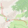
Mount Fremont Lookout
United States > Washington > Pierce County > Sunrise
From Sunrise in Yakima Park, the route climbs through open subalpine meadows onto Sourdough Ridge, with Mount Rainier and the Burroughs Mountain area gradually opening behind and beside the path. Near Frozen Lake, the trail leaves the busier junction area and continues onto the Mount Fremont Lookout Trail,…
Distance: 9.2 Km • Elevation gain: 370 m • Maximum elevation: 2,181 m


Castle Peak via Montezuma Basin Road and Castle Peak Trail in Maroon Bells–Snowmass Wilderness Area
United States > Colorado > Pitkin County
The Castle Peak hike via Montezuma Basin Road offers a beautiful yet challenging journey through the heart of Colorado's Elk Mountains. Starting from the rugged Montezuma Basin Road, hikers are treated to panoramic views of alpine meadows, towering peaks, and remnants of mining history. Along the route,…
Distance: 4.9 Km • Elevation gain: 919 m • Maximum elevation: 4,331 m

Strawberry Peak Trail in Angeles National Forest
United States > California > Los Angeles County
The Strawberry Peak Trail in Angeles National Forest offers hikers a challenging yet rewarding journey through diverse terrains. Starting from the Red Box Picnic Area, the path meanders through shaded canyons, ascends exposed ridges and rocky outcrops, culminating at the peak's distinctive, strawberry-shaped…
Distance: 11.6 Km • Elevation gain: 928 m • Maximum elevation: 1,863 m
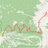
Humphreys Peak Trail in Kachina Peaks Wilderness
United States > Arizona > Coconino County
Humphreys Peak Trail, located in the Kachina Peaks Wilderness in Arizona, is a scenic and challenging hike that leads to the state's highest point. As the trail ascends, it traverses alpine meadows, lush forests and ancient volcanic fields, leading to a saddle that reveals panoramic views of the Inner Basin…
Distance: 16.3 Km • Elevation gain: 1,023 m • Maximum elevation: 3,834 m

Crown Point Loop via Bullion Basin Trail, Pacific Crest Trail and Silver Creek Trail
United States > Washington > Pierce County
The Crown Point Loop hike offers an immersive journey through some of the most beautiful alpine terrain in the Mount Baker-Snoqualmie National Forest. Starting with the Bullion Basin Trail, you'll wind through lush meadows and dense forests before reaching the ridge for expansive views. As you follow the…
Distance: 11.9 Km • Elevation gain: 711 m • Maximum elevation: 1,927 m
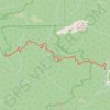
Silver Falls via Sunset Trail in Big Basin Redwoods State Park
United States > California > Santa Cruz County
The Sunset Trail offers a scenic and rewarding hiking experience, leading to three distinct waterfalls: Silver Falls, The Cascades, and Golden Falls. Along the way, hikers will be immersed in lush redwood forests, crossing over cool streams and ascending rocky terrain. The trail provides views of these…
Distance: 7.5 Km • Elevation gain: 362 m • Maximum elevation: 434 m

The Flatiron via Siphon Draw Trail in Tonto National Forest
United States > Arizona > Pinal County > Youngberg
The Flatiron via Siphon Draw Trail offers a challenging and rewarding hiking experience within the stunning Superstition Mountains of Tonto National Forest. The route begins with a rocky ascent through exposed terrain, gradually drawing you closer to the dramatic Flatiron peak, which stands out like the bow of…
Distance: 9.2 Km • Elevation gain: 835 m • Maximum elevation: 1,424 m
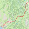
Cecret Lake Trail in Uinta-Wasatch-Cache National Forest
United States > Utah > Salt Lake County > Alta
The Cecret Lake Trail in the Uinta-Wasatch-Cache National Forest offers a beautiful and easy hike, especially in the summer when the Albion Basin is teeming with wildflowers. The route passes through open meadows with stunning views of surrounding peaks like Mount Superior and Devil's Castle, and the lake…
Distance: 2.8 Km • Elevation gain: 136 m • Maximum elevation: 3,010 m

Lake Mary Dam via Catherine's Pass Trail
United States > Utah > Salt Lake County > Alta
The Lake Mary Dam hike via Catherine’s Pass Trail offers a scenic and rewarding journey through the Uinta-Wasatch-Cache National Forest. Along the way, you'll encounter picturesque alpine lakes such as Lake Mary, Lake Martha, and Lake Catherine, with stunning views of rugged peaks like Mount Millicent. The…
Distance: 9.9 Km • Elevation gain: 538 m • Maximum elevation: 3,116 m

Monkey Rock Trail in Lake Tahoe Basin Management Unit
United States > Nevada > Washoe County > Incline Village-Crystal Bay
The Monkey Rock Trail via Tunnel Creek Road in the Lake Tahoe Basin Management Unit is a scenic, moderately challenging hike that offers hikers beautiful views of the surrounding wilderness. As you ascend, the trail provides expansive views of Lake Tahoe's azure waters framed by the surrounding Sierra Nevada…
Distance: 4.2 Km • Elevation gain: 155 m • Maximum elevation: 2,061 m

Osha Loop Trail in Lincoln National Forest
United States > New Mexico > Otero County
The Osha Loop Trail offers a delightful hiking experience with its blend of forested areas and stunning vistas. As you meander along the well-marked path, you'll be surrounded by tall conifers and perhaps catch sight of vibrant wildflowers during the summer months. The trail's moderate incline rewards hikers…
Distance: 4.1 Km • Elevation gain: 139 m • Maximum elevation: 2,641 m

Tidal Basin, Jefferson Memorial, Hains Point and East Potomac Park Loop
This loop hike offers a serene escape enriched with picturesque views of cherry blossom trees, expansive vistas of the Potomac River, and significant landmarks like the Thomas Jefferson Memorial. This route is especially vibrant during the cherry blossom season and is ideal for leisurely strolls, making it a…
Distance: 9.6 Km • Elevation gain: 35 m • Maximum elevation: 6 m

Andesite Peak Loop via Castle Valley North Road and Hole in the Ground
United States > California > Nevada County
The Andesite Peak Loop in the Tahoe National Forest, is a diverse and rewarding hike. Along the way, you'll traverse through lush meadows, ascend rocky ridgelines, and enjoy sweeping views of surrounding peaks like Castle Peak, with its volcanic features from ancient eruptions. The route provides an…
Distance: 7.7 Km • Elevation gain: 279 m • Maximum elevation: 2,458 m

Mount Tallac via Floating Island / Mount Tallac Trail in Lake Tahoe Basin Management Unit
United States > California > El Dorado County
The Mount Tallac Trail offers a breathtaking and demanding route with a rewarding summit experience. Early sections of the hike pass by serene alpine lakes like Floating Island Lake, offering a peaceful atmosphere and views of the surrounding mountains, including Fallen Leaf Lake. As you ascend, the trail…
Distance: 7.3 Km • Elevation gain: 977 m • Maximum elevation: 2,958 m

Red Mountain and Red Pond via Pacific Crest Trail and Commonwealth Basin Trail
United States > Washington > Kittitas County > Snoqualmie Pass
The hike to Red Mountain and Red Pond in the Alpine Lakes Wilderness offers an engaging combination of lush forests, scenic meadows, and expansive mountain views. The route begins with a gradual climb through old-growth forests, followed by a steeper ascent as you approach the saddle between Red Mountain and…
Distance: 12.6 Km • Elevation gain: 916 m • Maximum elevation: 1,721 m

Blue Bell Pass via Bullion Basin Trail
United States > Washington > Pierce County
This hike to Blue Bell Pass offers an immersive experience in the rugged beauty of the Mount Baker-Snoqualmie National Forest. As you ascend, you'll traverse lush meadows filled with wildflowers and enjoy sweeping views of the surrounding mountains, including Crystal Mountain and peaks of the North Cascades.…
Distance: 3.6 Km • Elevation gain: 470 m • Maximum elevation: 1,903 m
Lost Mine Trail in Big Bend National Park
United States > Texas > Brewster County > Chisos Mountains Basin Junction
The Lost Mine Trail in Big Bend National Park offers a breathtaking journey through the Chisos Mountains, with sweeping views of Juniper Canyon, Casa Grande, and the Sierra del Carmen in Mexico. As you ascend, the trail weaves through fragrant pine and oak forests, occasionally opening to dramatic vistas of…
Distance: 7.6 Km • Elevation gain: 344 m • Maximum elevation: 2,077 m

Seven Sacred Pools via Soldier Pass Trail in Coconino National Forest
United States > Arizona > Yavapai County > Sedona
The Soldier Pass Trail to the Seven Sacred Pools in Sedona offers a moderate hike through breathtaking red rock landscapes. Starting near Devil’s Kitchen, a dramatic sinkhole, the trail meanders past vibrant desert vegetation and sandstone formations, leading to the pools—small, naturally carved basins…
Distance: 1.9 Km • Elevation gain: 50 m • Maximum elevation: 1,384 m

Lost Mountain Trail in Big Bend National Park
United States > Texas > Brewster County > Chisos Mountains Basin Junction
The Lost Mine Trail in Big Bend National Park offers an exceptional hiking experience, blending moderate challenge with spectacular rewards. As you ascend through scrubby desert landscapes and switchbacks, you'll gradually gain sweeping views of the Juniper Valley and distant peaks like Casa Grande, providing…
Distance: 7.4 Km • Elevation gain: 344 m • Maximum elevation: 2,077 m

Linville Falls
United States > North Carolina > Burke County
Hike from Linville Gorge Parking to Linville Falls via Erwin's View Trail, Upper Falls Overlook, Chimney View, Gorge View, Erwin's View Outlook, Linville Falls Trail, Linville River, Plunge Basin Trail, Plunge Basin Overlook and Plunge Basin in the Blue Ridge Parkway and the Pisgah National Forest. #Hiking…
Distance: 7.8 Km • Elevation gain: 413 m • Maximum elevation: 1,019 m

Arch Rock Trail in Joshua Tree National Park
United States > California > Riverside County
The Arch Rock Trail in Joshua Tree National Park offers a brief yet rewarding hike, leading to the park's renowned Arch Rock. Along the way, hikers can observe unique rock formations, including the distinctive white tank boulders, and a variety of desert flora such as creosote bushes, ocotillo plants, various…
Distance: 2.1 Km • Elevation gain: 26 m • Maximum elevation: 1,193 m

Mount Liberty and Mount Flume
United States > New Hampshire > Grafton County > Lincoln
Hike to Mount Liberty and Mount Flume via Franconia Notch Bike Path, Liberty Spring Trail and Franconia Ridge Trail in the Franconia Notch State Park and the White Mountain National Forest. #Hiking #Mountain #Nature #Forest #Park
Distance: 14.3 Km • Elevation gain: 1,181 m • Maximum elevation: 1,329 m


Big Basin Redwoods Hike via Skyline to the Sea, Sunset, Middle Ridge, Hihn Hammond and Mount McAbee Overlook
United States > California > Santa Cruz County
Distance: 10.6 Km • Elevation gain: 448 m • Maximum elevation: 517 m


Morning MTB ride
Australia > Victoria > Melbourne
Morning Mountain Bike Ride
Distance: 35.8 Km • Elevation gain: 1,406 m • Maximum elevation: 549 m
