
Kennedy trails
Click on a trail to view its statistics, map and profile.
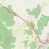


Cedar Tree Trail - Kennedy Falls
Canada > British Columbia > Metro Vancouver Regional District
Lynn Headwaters Regional Park. #Hiking #LynnHeadwaters #Kennedy
Distance: 5.5 Km • Elevation gain: 319 m • Maximum elevation: 473 m

Kennedy Falls - Cedar Tree Trail
Canada > British Columbia > Metro Vancouver Regional District
Lynn Headwaters Regional Park. #Hiking #LynnHeadwaters
Distance: 9.5 Km • Elevation gain: 429 m • Maximum elevation: 475 m
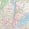
Old Croton Aqueduct Trail and Bronx
United States > New York > Westchester County > Village of Croton-on-Hudson
Distance: 70.8 Km • Elevation gain: 823 m • Maximum elevation: 80 m

Nelson-Kennedy Ledges State Park
United States > Ohio > Portage County > Nelson
Distance: 3.6 Km • Elevation gain: 71 m • Maximum elevation: 317 m

Deep River Loop Walk near Kennedy Creek
Canada > Ontario > Renfrew County > Deep River
Distance: 3.2 Km • Elevation gain: 39 m • Maximum elevation: 150 m

Maldon- Castlemaine Rail Trail
Distance: 16.9 Km • Elevation gain: 139 m • Maximum elevation: 360 m
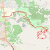
Great New trails at Napa Skyline
United States > California > Napa County > Napa
Distance: 30.8 Km • Elevation gain: 1,068 m • Maximum elevation: 451 m
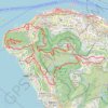
HK dino
China > Hong Kong > Hong Kong Island
Loop hike from Kennedy Town via Lung Fu Shan, High West, Victoria Peak, Pok Fu Lam Reservoir and Mount Davis in the Lung Fu Shan Country Park and the Pok Fu Lam Country Park. #Hiking #Loop #Nature #Mountain #Forest #Sea #Pacific #Ocean #Park
Distance: 24.4 Km • Elevation gain: 1,325 m • Maximum elevation: 529 m
金馬倫北坑 金馬倫西坑
China > Hong Kong > Hong Kong Island
Distance: 4.0 Km • Elevation gain: 340 m • Maximum elevation: 399 m
摩星嶺北坑
China > Hong Kong > Hong Kong Island
Distance: 2.8 Km • Elevation gain: 244 m • Maximum elevation: 242 m
摩星嶺北右坑
China > Hong Kong > Hong Kong Island
Loop hike
Distance: 4.1 Km • Elevation gain: 284 m • Maximum elevation: 239 m
西寧坑
China > Hong Kong > Hong Kong Island
Hong Kong Island Hike
Distance: 3.7 Km • Elevation gain: 264 m • Maximum elevation: 213 m

金鴨中段 灣仔峽南坑右源 灣仔峽北坑
China > Hong Kong > Hong Kong Island
Hong Kong Island Hike
Distance: 3.7 Km • Elevation gain: 199 m • Maximum elevation: 255 m