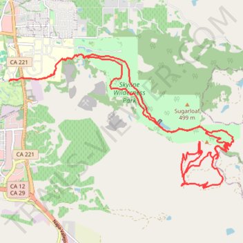
Great New trails at Napa Skyline
- Distance: 30.8 Km
- Elevation gain: 1,068 m
- Maximum elevation: 451 m
- Elevation loss: 1,068 m
- Minimum elevation: 5 m
Interactive trail map
Trail profile
- Distance: 30.8 Km
- Elevation gain: 1,068 m
- Maximum elevation: 451 m
- Elevation loss: 1,068 m
- Minimum elevation: 5 m
About this trail
Name: Great New trails at Napa Skyline trail, distance, elevation, map, profile, GPS track
Coordinates: 38.24334 -122.27577 38.27572 -122.20662