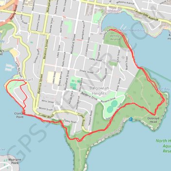
Manly to Spit Bridge Walk
Interactive trail map
Trail profile
- Distance: 9.4 Km
- Elevation gain: 275 m
- Maximum elevation: 86 m
- Elevation loss: 276 m
- Minimum elevation: 0 m
About this trail
Name: Manly to Spit Bridge Walk trail, distance, elevation, map, profile, GPS track
Coordinates: -33.81377 151.25125 -33.79999 151.27470
Topography: Sydney topographic map, elevation, terrain
Other hiking, mountain biking, running and outdoor activity trails
Click on a trail to view its statistics, map and profile.