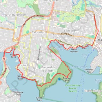
Manly to Spit Bridge Walk
Interactive trail map
Trail profile
- Distance: 10.8 Km
- Elevation gain: 263 m
- Maximum elevation: 85 m
- Elevation loss: 255 m
- Minimum elevation: -1 m
About this trail
Name: Manly to Spit Bridge Walk trail, distance, elevation, map, profile, GPS track
Coordinates: -33.81372 151.24608 -33.78845 151.28638
Topography: Sydney topographic map, elevation, terrain
Other hiking, mountain biking, running and outdoor activity trails
Click on a trail to view its statistics, map and profile.