Cleland Conservation Park - Mount Lofty
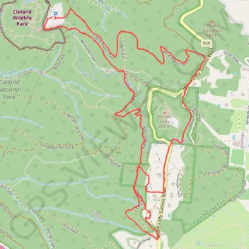
Interactive trail map
Trail profile
- Distance: 8.8 Km
- Elevation gain: 357 m
- Maximum elevation: 695 m
- Elevation loss: 353 m
- Minimum elevation: 514 m
About this trail
Name: Cleland Conservation Park - Mount Lofty trail, distance, elevation, map, profile, GPS track
Coordinates: -34.98482 138.69675 -34.96557 138.71318
Topography: South Australia topographic map, elevation, terrain
Other hiking, mountain biking, running and outdoor activity trails
Click on a trail to view its statistics, map and profile.
Belair National Park - Mount Lofty
Australia > South Australia > Adelaide
#Bike
Distance: 13.0 Km • Elevation gain: 503 m • Maximum elevation: 704 m