
Bexar County trails
Click on a trail to view its statistics, map and profile.
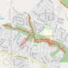
Red Bird Ranch Trails
United States > Texas > Bexar County
Redbird, Mountain bike, Trail, Hiking, Walking, Creek, Biking, Wandering
Distance: 8.2 Km • Elevation gain: 39 m • Maximum elevation: 299 m
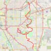
Tour from Jack White to SE Military w/ diversion to new Emory Oaks Trailhead
United States > Texas > Bexar County > San Antonio
Distance: 47.5 Km • Elevation gain: 221 m • Maximum elevation: 223 m
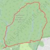
Loop hike via Recharge Trail, Far Reaches Trail and Wildcat Canyon Trail in Government Canyon State Natural Area
United States > Texas > Bexar County > San Antonio
Distance: 11.4 Km • Elevation gain: 153 m • Maximum elevation: 415 m
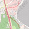
Walk underneath I-10
United States > Texas > Bexar County > San Antonio
Walk along trail and tracks
Distance: 5.2 Km • Elevation gain: 32 m • Maximum elevation: 318 m
Dignowity Park and Lockwood Park
United States > Texas > Bexar County > San Antonio
Distance: 0.5 Km • Elevation gain: 2 m • Maximum elevation: 228 m
Pittman-Sullivan Park
United States > Texas > Bexar County > San Antonio
Distance: 0.4 Km • Elevation gain: 4 m • Maximum elevation: 223 m