Red Bird Ranch Trails
Redbird, Mountain bike, Trail, Hiking, Walking, Creek, Biking, Wandering
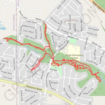
- Distance: 8.2 Km
- Elevation gain: 39 m
- Maximum elevation: 299 m
- Elevation loss: 39 m
- Minimum elevation: 281 m
Interactive trail map
Trail profile
- Distance: 8.2 Km
- Elevation gain: 39 m
- Maximum elevation: 299 m
- Elevation loss: 39 m
- Minimum elevation: 281 m
About this trail
Name: Red Bird Ranch Trails trail, distance, elevation, map, profile, GPS track
Start: Poolside, Redbird Ranch, Bexar County, Texas, United States (29.43241 -98.79737)
End: Poolside, Redbird Ranch, Bexar County, Texas, United States (29.43250 -98.79729)
Coordinates: 29.42990 -98.80762 29.43945 -98.78944