Import a GPX file

Eastern Cape trails

Click on a trail to view its statistics, map and profile.
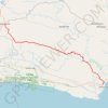
Willowmore - Jeffreys Bay

South Africa > Eastern Cape > Sarah Baartman District Municipality > Baviaans Local Municipality > Willowmore

#Bike

Distance: 225.9 Km • Elevation gain: 3,576 m • Maximum elevation: 1,156 m
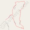
The Tsitsikamma Big Tree

South Africa > Eastern Cape > Sarah Baartman District Municipality > Kou-Kamma Local Municipality > Stormsrivier

#Hiking #Loop

Distance: 1.2 Km • Elevation gain: 15 m • Maximum elevation: 265 m

Other places

 •

Gear up for your next adventure:

🎒Tactical Waist Packs - Quick access to your compass, phone, and snacks while walking
🖼️Scratch-off Australia Map - Track the regions and peaks you have explored geographically
🏃Compression Recovery Socks - Reduce leg fatigue after heavy days of elevation gain
👕UPF 50+ Sun Shirts - Essential protection against the harsh Australian sun during field work
📕Australia Maps - Maps covering Australian regions

As an Amazon Associate, this site earns from qualifying purchases at no extra cost to you.