Import a GPX file

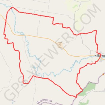
Killarney to Warwick via Barlows Gate

#MTB #Loop

  • Distance: 83.4 Km
  • Elevation gain: 1,032 m
  • Maximum elevation: 667 m
  • Elevation loss: 1,032 m
  • Minimum elevation: 453 m

Interactive trail map

Trail profile

  • Distance: 83.4 Km
  • Elevation gain: 1,032 m
  • Maximum elevation: 667 m
  • Elevation loss: 1,032 m
  • Minimum elevation: 453 m

About this trail

Other hiking, mountain biking, running and outdoor activity trails

Click on a trail to view its statistics, map and profile.

Tannymorel - Bald Mountain

Australia > Queensland

Gambubal State Forest. Main Range National Park. #MTB #Loop #Gambubal #MainRange

Distance: 59.1 Km • Elevation gain: 1,460 m • Maximum elevation: 1,194 m

Killarney to Warwick via Tannymorel

Australia > Queensland

#MTB #Loop

Distance: 77.0 Km • Elevation gain: 855 m • Maximum elevation: 668 m

Gear up for your next adventure:

🛌Sleeping Mats - Insulated mats for camping comfort
👣Snake & Scrub Gaiters - Protection against spinifex, mud, and snakes while walking off-track
🪫Rechargeable Headlamps - USB rechargeable headlamps
🌬️Windbreaker Jackets - Wind protection jackets
🎨Portable Watercolor Kits - Paint the landscapes and topographic views you discover

As an Amazon Associate, this site earns from qualifying purchases at no extra cost to you.