Import a GPX file

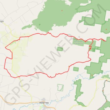
Tannymorel - Bald Mountain

Gambubal State Forest. Main Range National Park. #MTB #Loop #Gambubal #MainRange

  • Distance: 59.1 Km
  • Elevation gain: 1,460 m
  • Maximum elevation: 1,194 m
  • Elevation loss: 1,460 m
  • Minimum elevation: 491 m

Interactive trail map

Trail profile

  • Distance: 59.1 Km
  • Elevation gain: 1,460 m
  • Maximum elevation: 1,194 m
  • Elevation loss: 1,460 m
  • Minimum elevation: 491 m

About this trail

Other hiking, mountain biking, running and outdoor activity trails

Click on a trail to view its statistics, map and profile.

Killarney to Warwick via Barlows Gate

Australia > Queensland

#MTB #Loop

Distance: 83.4 Km • Elevation gain: 1,032 m • Maximum elevation: 667 m

Killarney to Warwick via Tannymorel

Australia > Queensland

#MTB #Loop

Distance: 77.0 Km • Elevation gain: 855 m • Maximum elevation: 668 m

Warwick - Gatton

Australia > Queensland > Warwick

#Bike

Distance: 125.3 Km • Elevation gain: 812 m • Maximum elevation: 582 m

Gear up for your next adventure:

🚁Camera Drones with GPS - Capture aerial views of the landscape to compare with topo maps
🥤Outdoor Water Bottles - Reusable bottles for outdoor activities
📟Satellite Messengers - Two-way satellite communication to stay in touch beyond the cellular grid
🧥Softshell Jackets - Flexible outdoor jackets
🥾Heavy Duty Hiking Boots - Ankle-supporting boots for carrying heavy packs on steep contours

As an Amazon Associate, this site earns from qualifying purchases at no extra cost to you.