Mount Baker via Heliotrope Ridge Trail and Coleman-Deming Route
The Heliotrope Ridge Trail, followed by the Coleman-Deming Route, offers hikers and mountaineers a unique blend of challenging terrain and breathtaking vistas as they approach Mount Baker’s summit. As you ascend, the trail takes you past scenic alpine meadows and views of towering glaciers, particularly the striking Coleman Glacier, which dominates the landscape. With a mix of exposed rocky slopes, glacier crossings, and the dramatic Roman Wall, the route offers a rewarding challenge to those with technical climbing skills, while panoramic views from the summit provide a sense of accomplishment for all adventurers. #Mountaineering #Glacier #Forest #Nature
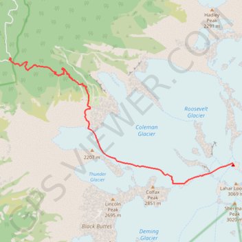
- Distance: 10.3 Km
- Elevation gain: 2,166 m
- Maximum elevation: 3,267 m
- Elevation loss: 52 m
- Minimum elevation: 1,127 m
Interactive trail map
Trail profile
- Distance: 10.3 Km
- Elevation gain: 2,166 m
- Maximum elevation: 3,267 m
- Elevation loss: 52 m
- Minimum elevation: 1,127 m
About this trail
Name: Mount Baker via Heliotrope Ridge Trail and Coleman-Deming Route trail, distance, elevation, map, profile, GPS track
Start: Glacier Creek Road, Whatcom County, Washington, United States (48.80175 -121.89628)
End: Boulder Glacier Route, Whatcom County, Washington, United States (48.77680 -121.81447)
Coordinates: 48.77205 -121.89628 48.80227 -121.81447
Other hiking, mountain biking, running and outdoor activity trails
Click on a trail to view its statistics, map and profile.
Northern part of the Pacific Crest Trail (PCT)
United States > Oregon > Klamath County
Hike on the Pacific Crest National Scenic Trail from Crater Lake to Canada Border through Oregon and Washington along the Sierra Nevada and Cascade mountain ranges. #Hiking #Mountain #SierraNevada #Cascade #Nature #Forest #Park #PCT
Distance: 1,198.3 Km • Elevation gain: 44,308 m • Maximum elevation: 2,307 m
Baker Ridge
United States > Washington > Whatcom County
Ski touring. #Ski #SkiTouring
Distance: 8.0 Km • Elevation gain: 1,629 m • Maximum elevation: 2,746 m