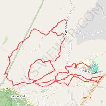
Campbell Scout Camp
- Distance: 21.5 Km
- Elevation gain: 463 m
- Maximum elevation: 2,227 m
- Elevation loss: 463 m
- Minimum elevation: 2,063 m
- Moving time: 3 h 9 m
- Moving speed: 6.8 Km/h
- Maximum speed: 32.8 Km/h
- Total time: 4 h 19 m
- Global speed: 5.0 Km/h
Interactive trail map
Trail profile
- Distance: 21.5 Km
- Elevation gain: 463 m
- Maximum elevation: 2,227 m
- Elevation loss: 463 m
- Minimum elevation: 2,063 m
- Moving time: 3 h 9 m
- Moving speed: 6.8 Km/h
- Maximum speed: 32.8 Km/h
- Total time: 4 h 19 m
- Global speed: 5.0 Km/h
About this trail
Name: Campbell Scout Camp trail, distance, elevation, map, profile, GPS track
Coordinates: 35.17050 -106.36999 35.18825 -106.33805
Other hiking, mountain biking, running and outdoor activity trails
Click on a trail to view its statistics, map and profile.
Campbell Ranch
United States > New Mexico > Bernalillo County
Distance: 14.3 Km • Elevation gain: 314 m • Maximum elevation: 2,189 m