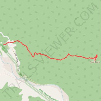
Walk to Glen Rock, QLD
- Distance: 5.0 Km
- Elevation gain: 463 m
- Maximum elevation: 787 m
- Elevation loss: 462 m
- Minimum elevation: 339 m
- Moving time: 2 h 17 m
- Moving speed: 2.2 Km/h
- Maximum speed: 4.7 Km/h
- Total time: 4 h 50 m
- Global speed: 1.0 Km/h
Interactive trail map
Trail profile
- Distance: 5.0 Km
- Elevation gain: 463 m
- Maximum elevation: 787 m
- Elevation loss: 462 m
- Minimum elevation: 339 m
- Moving time: 2 h 17 m
- Moving speed: 2.2 Km/h
- Maximum speed: 4.7 Km/h
- Total time: 4 h 50 m
- Global speed: 1.0 Km/h
About this trail
Name: Walk to Glen Rock, QLD trail, distance, elevation, map, profile, GPS track
Coordinates: -27.89052 152.24686 -27.88699 152.26563
Topography: Queensland topographic map, elevation, terrain
Other hiking, mountain biking, running and outdoor activity trails
Click on a trail to view its statistics, map and profile.
Warwick - Gatton
Australia > Queensland > Warwick
#Bike
Distance: 125.3 Km • Elevation gain: 812 m • Maximum elevation: 582 m
Black Duck
Distance: 45.6 Km • Elevation gain: 627 m • Maximum elevation: 569 m