7 Ascents in the Dead Sea
שבע מעלות בים המלח: קו עליות דרך עשאל, משמר, צאלים ומצדה
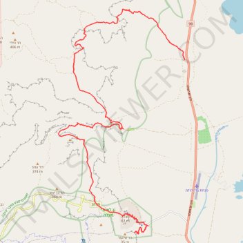
- Distance: 31.2 Km
- Elevation gain: 2,112 m
- Maximum elevation: 275 m
- Elevation loss: 2,028 m
- Minimum elevation: -386 m
- Moving time: 11 h 17 m
- Moving speed: 2.8 Km/h
- Maximum speed: 4.6 Km/h
- Total time: 11 h 17 m
- Global speed: 2.8 Km/h
Interactive trail map
Trail profile
- Distance: 31.2 Km
- Elevation gain: 2,112 m
- Maximum elevation: 275 m
- Elevation loss: 2,028 m
- Minimum elevation: -386 m
- Moving time: 11 h 17 m
- Moving speed: 2.8 Km/h
- Maximum speed: 4.6 Km/h
- Total time: 11 h 17 m
- Global speed: 2.8 Km/h
About this trail
Name: 7 Ascents in the Dead Sea trail, distance, elevation, map, profile, GPS track
Coordinates: 31.30871 35.32156 31.40107 35.38230
Other hiking, mountain biking, running and outdoor activity trails
Click on a trail to view its statistics, map and profile.
Ein Gedi - Mishmar
Israel > South District > Tamar Regional Council > Ein Gedi
עין גדי לנחל משמר: קו זורם על במת מדבר יהודה וביקור בעין חבר
Distance: 18.7 Km • Elevation gain: 827 m • Maximum elevation: 275 m
Tzeelim - Mishmar
Israel > South District > Tamar Regional Council
צאלים ומשמר: שלוש מעלות טכנים, שני קניונים ובמת מדבר אחת
Distance: 19.9 Km • Elevation gain: 1,047 m • Maximum elevation: 294 m
Tzeelim Challenge
Israel > South District > Tamar Regional Council
אתגר צאלים: שמונה מעלות של קניון צאלים
Distance: 40.6 Km • Elevation gain: 2,409 m • Maximum elevation: 356 m
Tzeelim Circle
Israel > South District > Tamar Regional Council
סובב צאלים: מסלול יפיפה דרך בריכת צפירה ומעלה ענבה
Distance: 25.2 Km • Elevation gain: 1,203 m • Maximum elevation: 369 m
Mesada - Arad
Israel > South District > Tamar Regional Council
מצדה לערד: קו ארוך לרוחב מדבר יהודה
Distance: 19.0 Km • Elevation gain: 1,219 m • Maximum elevation: 577 m