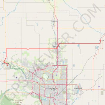
Import a GPX file

Cochrane - Irricana

#Bike #Cochrane #Irricana

  • Distance: 79.0 Km
  • Elevation gain: 546 m
  • Maximum elevation: 1,304 m
  • Elevation loss: 734 m
  • Minimum elevation: 933 m

Interactive trail map

Trail profile

  • Distance: 79.0 Km
  • Elevation gain: 546 m
  • Maximum elevation: 1,304 m
  • Elevation loss: 734 m
  • Minimum elevation: 933 m

About this trail

Name: Cochrane - Irricana trail, distance, elevation, map, profile, GPS track

Start: Bow Rivers Edge Campground, Rockland Avenue, Town of Cochrane, Alberta, T4C 2C3, Canada (51.17536 -114.45591)

End: 300, 1st Street, Town of Irricana, Alberta, T0M 1B0, Canada (51.32325 -113.60644)

Coordinates: 51.17536 -114.48690 51.32366 -113.60644

Other hiking, mountain biking, running and outdoor activity trails

Click on a trail to view its statistics, map and profile.

Irricana - Drumheller

Canada > Alberta > Town of Irricana

#Bike #Irricana #Drumheller

Distance: 75.0 Km • Elevation gain: 314 m • Maximum elevation: 942 m

Gear up for your next adventure:

🧭Compass - Navigation compasses for outdoor exploration
🛌Compact Down Sleeping Bags - Warmth without the bulk, ideal for backcountry camping
🦯Adjustable Trekking Poles - Reduce impact on knees when descending steep topographic ridges
🧥Down Jackets - Insulated jackets for cold weather
📚Map Reading & Navigation Guides - Master the art of interpreting topographic contours and symbols

As an Amazon Associate, this site earns from qualifying purchases at no extra cost to you.