Import a GPX file

Drumheller trails

Click on a trail to view its statistics, map and profile.
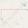
Drumheller - Hanna

Canada > Alberta > Drumheller > Drumheller

#Bike #Drumheller #Hanna

Distance: 78.8 Km • Elevation gain: 439 m • Maximum elevation: 914 m
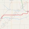
Irricana - Drumheller

Canada > Alberta > Town of Irricana

#Bike #Irricana #Drumheller

Distance: 75.0 Km • Elevation gain: 314 m • Maximum elevation: 942 m

Gear up for your next adventure:

📚Map Reading & Navigation Guides - Master the art of interpreting topographic contours and symbols
🛌Sleeping Bags - Sleeping bags for outdoor camping
🎒Hiking Backpacks - Backpacks designed for hiking and trekking
📻Handheld UHF Radios - Critical communication for groups in the Australian outback
🖼️Scratch-off Australia Map - Track the regions and peaks you have explored geographically

As an Amazon Associate, this site earns from qualifying purchases at no extra cost to you.