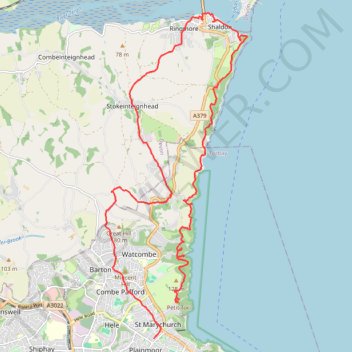
Babbacombe Shaldon Loop
- Distance: 22.4 Km
- Elevation gain: 945 m
- Maximum elevation: 164 m
- Elevation loss: 946 m
- Minimum elevation: 0 m
- Moving time: 6 h 39 m
- Moving speed: 3.4 Km/h
- Maximum speed: 7.7 Km/h
- Total time: 7 h 16 m
- Global speed: 3.1 Km/h
Interactive trail map
Trail profile
- Distance: 22.4 Km
- Elevation gain: 945 m
- Maximum elevation: 164 m
- Elevation loss: 946 m
- Minimum elevation: 0 m
- Moving time: 6 h 39 m
- Moving speed: 3.4 Km/h
- Maximum speed: 7.7 Km/h
- Total time: 7 h 16 m
- Global speed: 3.1 Km/h
About this trail
Name: Babbacombe Shaldon Loop trail, distance, elevation, map, profile, GPS track
Start: Petitor Road, St Marychurch, Torquay, Torbay, England, TQ1 4QG, United Kingdom (50.48714 -3.51745)
Coordinates: 50.47995 -3.53948 50.54218 -3.49663