Import a GPX file

Torbay trails

Click on a trail to view its statistics, map and profile.
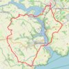
Galmpton Stoke Fleming

United Kingdom > England > Torbay > Galmpton

Distance: 30.1 Km • Elevation gain: 815 m • Maximum elevation: 188 m
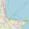
Brixham Paignton Loop Hike

United Kingdom > England > Torbay > Brixham

Distance: 30.6 Km • Elevation gain: 585 m • Maximum elevation: 64 m
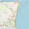
Babbacombe Shaldon Loop

United Kingdom > England > Torbay > Torquay

Distance: 22.4 Km • Elevation gain: 945 m • Maximum elevation: 164 m

Other places

 •  •

Gear up for your next adventure:

🚴Bike GPS - GPS devices for cycling
🥶Thermal Beanies - Warm hats for cold hikes
📡Portable Emergency Radios - Stay informed about weather warnings and bushfire alerts
🧭Military Style Lensatic Compass - Durable sighting compasses for advanced land navigation and surveying
🧥Down Jackets - Insulated jackets for cold weather

As an Amazon Associate, this site earns from qualifying purchases at no extra cost to you.