Import a GPX file

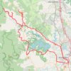
Kobble Creek - North Pine Dam

North Pine Dam Nature Refuge. #MTB #Loop #NorthPine

  • Distance: 28.5 Km
  • Elevation gain: 406 m
  • Maximum elevation: 96 m
  • Elevation loss: 407 m
  • Minimum elevation: 37 m

Interactive trail map

Trail profile

  • Distance: 28.5 Km
  • Elevation gain: 406 m
  • Maximum elevation: 96 m
  • Elevation loss: 407 m
  • Minimum elevation: 37 m

About this trail

Other hiking, mountain biking, running and outdoor activity trails

Click on a trail to view its statistics, map and profile.
Kobble Creek - Lake Samsonvale

Australia > Queensland

North Pine Dam Nature Reserve. #MTB #Loop #NorthPine #Kobble #Samsonvale

Distance: 24.1 Km • Elevation gain: 292 m • Maximum elevation: 75 m

Mount Glorious - North Kobble Creek campsite

Australia > Queensland

D'Aguilar National Park. #MTB #Loop #DAguilar

Distance: 40.0 Km • Elevation gain: 1,369 m • Maximum elevation: 741 m

Dayboro - Mount Mee - Kobble Creek

Australia > Queensland > City of Brisbane

Lake Samsonvale. #Bike #Loop #Samsonvale #Mee #Kobble #Brisbane

Distance: 112.5 Km • Elevation gain: 1,817 m • Maximum elevation: 421 m

Dayboro - Wamuran

Australia > Queensland > City of Brisbane

D'Aguilar National Park. #MTB #DAguilar

Distance: 84.6 Km • Elevation gain: 2,030 m • Maximum elevation: 541 m

Gear up for your next adventure:

🖼️Scratch-off Australia Map - Track the regions and peaks you have explored geographically
🎽Base Layers - Thermal base layers
🧺Fast-Dry Microfiber Towels - Large towels that pack down to the size of an orange
🧥Thermal Emergency Blankets - Compact Mylar blankets to prevent hypothermia if stranded overnight
🏕️Camping Gear - Essential camping equipment

As an Amazon Associate, this site earns from qualifying purchases at no extra cost to you.