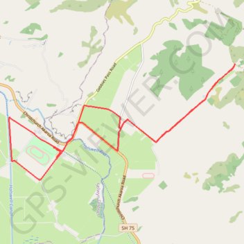
Birdlings Flat Gravel/Unpaved Cycling
- Distance: 21.5 Km
- Elevation gain: 111 m
- Maximum elevation: 38 m
- Elevation loss: 112 m
- Minimum elevation: 1 m
- Moving time: 1 h 10 s
- Moving speed: 21.4 Km/h
- Maximum speed: 29.4 Km/h
- Total time: 1 h 10 s
- Global speed: 21.4 Km/h
Interactive trail map
Trail profile
- Distance: 21.5 Km
- Elevation gain: 111 m
- Maximum elevation: 38 m
- Elevation loss: 112 m
- Minimum elevation: 1 m
- Moving time: 1 h 10 s
- Moving speed: 21.4 Km/h
- Maximum speed: 29.4 Km/h
- Total time: 1 h 10 s
- Global speed: 21.4 Km/h
About this trail
Name: Birdlings Flat Gravel/Unpaved Cycling trail, distance, elevation, map, profile, GPS track
Coordinates: -43.73734 172.57135 -43.70717 172.65251
Other hiking, mountain biking, running and outdoor activity trails
Click on a trail to view its statistics, map and profile.
Halswell River
New Zealand > Canterbury > Christchurch City > Banks Peninsula Community
Distance: 68.9 Km • Elevation gain: 320 m • Maximum elevation: 40 m