Import a GPX file

Christchurch trails

Click on a trail to view its statistics, map and profile.
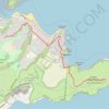
Pleasant - Lyttelton

New Zealand > Canterbury > Christchurch City > Christchurch

#Running #Loop

Distance: 12.3 Km • Elevation gain: 677 m • Maximum elevation: 408 m

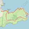
Clifton to Godley Head

New Zealand > Canterbury > Christchurch City > Christchurch

Hike from Clifton to Godley Head via Sumner, Scarborough and Taylors Mistake. #Hiking #Nature #Sea #Pacific #Ocean #Coast

Distance: 8.3 Km • Elevation gain: 356 m • Maximum elevation: 218 m

Godley Head Walkway, Awaroa-Godley Head Loop Track and Crater Rim Walkway hike

New Zealand > Canterbury > Christchurch City > Christchurch

Distance: 8.9 Km • Elevation gain: 418 m • Maximum elevation: 204 m
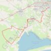
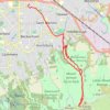
South Canterbury

New Zealand > Canterbury > Christchurch City > Christchurch

#Bike #Loop

Distance: 115.9 Km • Elevation gain: 312 m • Maximum elevation: 61 m

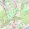
Rapaki Track via MTB Singletrack

New Zealand > Canterbury > Christchurch City > Christchurch

Distance: 13.1 Km • Elevation gain: 400 m • Maximum elevation: 332 m

Gear up for your next adventure:

🧼Clip-on Hand Sanitizer - Maintain hygiene when water for washing is scarce
🚴Cycling Backpacks - Backpacks for cyclists
🎒Tactical Waist Packs - Quick access to your compass, phone, and snacks while walking
🎽Hiking Clothing - Breathable clothing for hiking
🧼Biodegradable Outdoor Soap - Clean gear and yourself without harming the local ecosystem

As an Amazon Associate, this site earns from qualifying purchases at no extra cost to you.