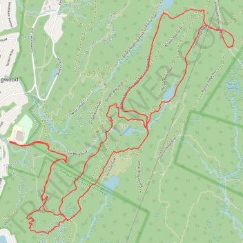
Ringwood State Park
- Distance: 12.3 Km
- Elevation gain: 309 m
- Maximum elevation: 327 m
- Elevation loss: 309 m
- Minimum elevation: 170 m
- Moving time: 1 h 23 m
- Moving speed: 8.9 Km/h
- Maximum speed: 26.7 Km/h
- Total time: 2 h 8 m
- Global speed: 5.7 Km/h
Interactive trail map
Trail profile
- Distance: 12.3 Km
- Elevation gain: 309 m
- Maximum elevation: 327 m
- Elevation loss: 309 m
- Minimum elevation: 170 m
- Moving time: 1 h 23 m
- Moving speed: 8.9 Km/h
- Maximum speed: 26.7 Km/h
- Total time: 2 h 8 m
- Global speed: 5.7 Km/h
About this trail
Name: Ringwood State Park trail, distance, elevation, map, profile, GPS track
Coordinates: 41.09965 -74.24491 41.11964 -74.21844
Other hiking, mountain biking, running and outdoor activity trails
Click on a trail to view its statistics, map and profile.
Ramapo Valley County Reservation Loop Hike: Scarlet Oak Pond, Bald Mountain, Bear Swamp Lake, MacMillan Reservoir
United States > New Jersey > Bergen County > Mahwah > Darlington
Starting from the Darlington side of Ramapo Valley County Reservation, this loop follows Vista Spur Trail toward the Ramapo River before joining Pond Loop Trail beside Scarlet Oak Pond. The route soon leaves the water on Vista Loop, climbing through the forest to Hawk Rock and Cactus Ledge, where open rock…
Distance: 19.4 Km • Elevation gain: 524 m • Maximum elevation: 351 m
Loop Hike to Bear Swamp Lake in Ramapo Valley County Reservation
United States > New Jersey > Bergen County > Mahwah > Darlington
Distance: 11.8 Km • Elevation gain: 350 m • Maximum elevation: 269 m
Ringwood
United States > New Jersey > Passaic County > Ringwood > Erskine Lakes
Distance: 17.4 Km • Elevation gain: 356 m • Maximum elevation: 261 m
Northern Ringwood State Park
United States > New Jersey > Passaic County > Ringwood > Erskine Lakes
Distance: 18.1 Km • Elevation gain: 365 m • Maximum elevation: 261 m