Grandview Trail (Grand Canyon)
Hike along the Grandview Trail from Grandview Point in the Grand Canyon National Park. #Hiking #Canyon #Mountain #Nature #Rock #River #Park
- Distance: 13.8 Km
- Elevation gain: 1,150 m
- Maximum elevation: 2,254 m
- Elevation loss: 1,071 m
- Minimum elevation: 1,457 m
- Moving time: 4 h 27 m
- Moving speed: 3.1 Km/h
- Maximum speed: 9.2 Km/h
- Total time: 5 h 18 m
- Global speed: 2.6 Km/h
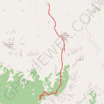
Interactive trail map
Trail profile
- Distance: 13.8 Km
- Elevation gain: 1,150 m
- Maximum elevation: 2,254 m
- Elevation loss: 1,071 m
- Minimum elevation: 1,457 m
- Moving time: 4 h 27 m
- Moving speed: 3.1 Km/h
- Maximum speed: 9.2 Km/h
- Total time: 5 h 18 m
- Global speed: 2.6 Km/h
About this trail
Name: Grandview Trail (Grand Canyon) trail, distance, elevation, map, profile, GPS track
Start: Grandview Trail, Coconino County, Arizona, United States (35.99913 -111.98718)
End: Grandview Trail, Coconino County, Arizona, United States (35.99805 -111.98790)
Coordinates: 35.99805 -111.98790 36.03572 -111.97553
Other hiking, mountain biking, running and outdoor activity trails
Click on a trail to view its statistics, map and profile.