Green Mountain
Interactive trail map
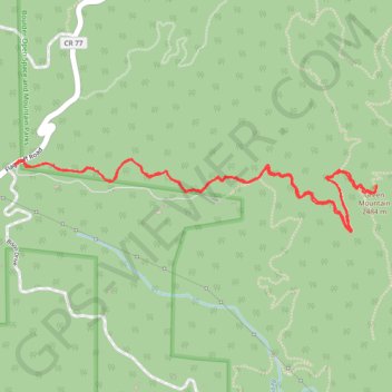
Trail profile
- Distance: 6.3 Km
- Elevation gain: 234 m
- Maximum elevation: 2,450 m
- Elevation loss: 234 m
- Minimum elevation: 2,303 m
About this trail
Name: Green Mountain trail, distance, elevation, map, profile, GPS track
Start: Flagstaff Road, Boulder County, Colorado, 80302, United States (39.98319 -105.32372)
End: Flagstaff Road, Boulder County, Colorado, 80302, United States (39.98322 -105.32370)
Coordinates: 39.98001 -105.32372 39.98343 -105.30148
Other hiking, mountain biking, running and outdoor activity trails
Click on a trail to view its statistics, map and profile.
Green Mountain via Gregory Canyon Trail and Ranger Trail
United States > Colorado > Boulder County
The Green Mountain hike via Gregory Canyon and Ranger Trails offers a moderately challenging journey through varied terrain, with sweeping views of the Boulder Valley and surrounding peaks. Hikers will experience a mix of shaded forest paths, rocky ridgelines, and open meadows, culminating in panoramic vistas…
Distance: 4.4 Km • Elevation gain: 673 m • Maximum elevation: 2,449 m
Green Mountain West Ridge Trail in Boulder Open Space and Mountain Parks
United States > Colorado > Boulder County
The Green Mountain West Ridge Trail in Boulder Open Space and Mountain Parks offers a challenging yet rewarding hike with expansive views of the surrounding landscape. Hikers are treated to panoramic vistas of Boulder, the Flatirons, and the expansive Rocky Mountain range, all framed by diverse ecosystems,…
Distance: 6.2 Km • Elevation gain: 239 m • Maximum elevation: 2,449 m