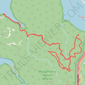
Muogamarra Nature Preserve - Western Lookout, Tipper Lookout, Peats Bight, Lloyd Trig, Deerubbin Lookover
- Distance: 16.7 Km
- Elevation gain: 561 m
- Maximum elevation: 221 m
- Elevation loss: 554 m
- Minimum elevation: 1 m
- Moving time: 4 h 10 m
- Moving speed: 4.0 Km/h
- Maximum speed: 20.7 Km/h
- Total time: 5 h 56 m
- Global speed: 2.8 Km/h
Interactive trail map
Trail profile
- Distance: 16.7 Km
- Elevation gain: 561 m
- Maximum elevation: 221 m
- Elevation loss: 554 m
- Minimum elevation: 1 m
- Moving time: 4 h 10 m
- Moving speed: 4.0 Km/h
- Maximum speed: 20.7 Km/h
- Total time: 5 h 56 m
- Global speed: 2.8 Km/h
About this trail
Name: Muogamarra Nature Preserve - Western Lookout, Tipper Lookout, Peats Bight, Lloyd Trig, Deerubbin Lookover trail, distance, elevation, map, profile, GPS track
Coordinates: -33.55472 151.16091 -33.53442 151.19424
Topography: Sydney topographic map, elevation, terrain
Other hiking, mountain biking, running and outdoor activity trails
Click on a trail to view its statistics, map and profile.