Import a GPX file

KuRingGai trails

Click on a trail to view its statistics, map and profile.

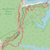
Ku-ring-gai Chase National Park

Australia > New South Wales > Sydney > Cowan

#Hiking #KuRingGai

Distance: 13.8 Km • Elevation gain: 439 m • Maximum elevation: 194 m

Gear up for your next adventure:

🗺️Topographic Maps - Detailed maps for hiking and navigation
🐍Snake Gaiters - Protection against snake bites
🖼️Scratch-off Australia Map - Track the regions and peaks you have explored geographically
🥾Hiking Boots - Durable hiking boots for trails and rough terrain
🚁Camera Drones with GPS - Capture aerial views of the landscape to compare with topo maps

As an Amazon Associate, this site earns from qualifying purchases at no extra cost to you.