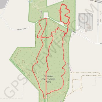
Kinchina Conservation Park
Interactive trail map
Trail profile
- Distance: 13.5 Km
- Elevation gain: 249 m
- Maximum elevation: 143 m
- Elevation loss: 249 m
- Minimum elevation: 49 m
About this trail
Name: Kinchina Conservation Park trail, distance, elevation, map, profile, GPS track
Start: Getaway Car, The Rural City of Murray Bridge, South Australia, Australia (-35.11265 139.22723)
End: Getaway Car, The Rural City of Murray Bridge, South Australia, Australia (-35.11273 139.22713)
Coordinates: -35.12972 139.21950 -35.10906 139.22957
Topography: The Rural City of Murray Bridge topographic map, elevation, terrain
Other hiking, mountain biking, running and outdoor activity trails
Click on a trail to view its statistics, map and profile.