Lower Macleay Trail and Wildwood Trail to Pittock Mansion
The hike to Pittock Mansion via the Lower Macleay and Wildwood Trails is an enjoyable route through Portland’s lush Forest Park, offering a variety of natural sights. Starting from Lower Macleay Park, you will pass the Witch's Castle, a unique stone structure hidden in the woods, cross over Balch Creek, and continue up the winding Wildwood Trail to Pittock Mansion, an early 20th-century chateau offering one of the best panoramic views of downtown Portland and Mount Hood. #Hiking #Castle #Forest #Nature #Overlook
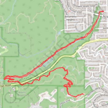
- Distance: 8.6 Km
- Elevation gain: 405 m
- Maximum elevation: 295 m
- Elevation loss: 403 m
- Minimum elevation: 28 m
- Moving time: 1 h 55 m
- Moving speed: 4.4 Km/h
- Maximum speed: 13.0 Km/h
- Total time: 2 h 15 m
- Global speed: 3.8 Km/h
Interactive trail map
Trail profile
- Distance: 8.6 Km
- Elevation gain: 405 m
- Maximum elevation: 295 m
- Elevation loss: 403 m
- Minimum elevation: 28 m
- Moving time: 1 h 55 m
- Moving speed: 4.4 Km/h
- Maximum speed: 13.0 Km/h
- Total time: 2 h 15 m
- Global speed: 3.8 Km/h
About this trail
Name: Lower Macleay Trail and Wildwood Trail to Pittock Mansion trail, distance, elevation, map, profile, GPS track
Coordinates: 45.52515 -122.72960 45.53601 -122.71158
Other hiking, mountain biking, running and outdoor activity trails
Click on a trail to view its statistics, map and profile.
The Watcher in the Water
United States > Oregon > Multnomah County > Portland
Distance: 82.9 Km • Elevation gain: 1,451 m • Maximum elevation: 300 m