Phoenix
- Distance: 3.4 Km
- Elevation gain: 38 m
- Maximum elevation: 362 m
- Elevation loss: 29 m
- Minimum elevation: 339 m
Interactive trail map
Trail profile
- Distance: 3.4 Km
- Elevation gain: 38 m
- Maximum elevation: 362 m
- Elevation loss: 29 m
- Minimum elevation: 339 m
About this trail
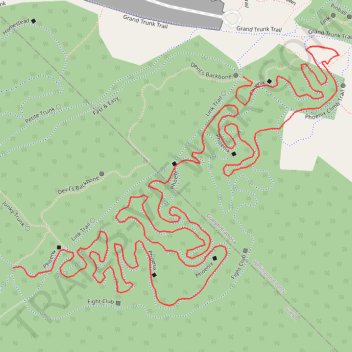
Name: Phoenix trail, distance, elevation, map, profile, GPS track
Coordinates: 43.58914 -80.26707 43.59308 -80.26023
Other hiking, mountain biking, running and outdoor activity trails
Click on a trail to view its statistics, map and profile.
Paths and trails in Guelph
Distance: 20.0 Km • Elevation gain: 133 m • Maximum elevation: 366 m
Ontario country roads
Distance: 150.4 Km • Elevation gain: 1,137 m • Maximum elevation: 497 m
Phoenix MTB Trail
Distance: 3.3 Km • Elevation gain: 35 m • Maximum elevation: 361 m