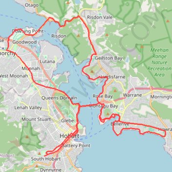
South Hobart - Howrah - Bowen Bridge
Interactive trail map
Trail profile
- Distance: 49.9 Km
- Elevation gain: 599 m
- Maximum elevation: 72 m
- Elevation loss: 598 m
- Minimum elevation: -2 m
About this trail
Name: South Hobart - Howrah - Bowen Bridge trail, distance, elevation, map, profile, GPS track
Coordinates: -42.89461 147.27783 -42.81219 147.40549
Topography: Hobart topographic map, elevation, terrain
Other hiking, mountain biking, running and outdoor activity trails
Click on a trail to view its statistics, map and profile.
South Hobart - Wellington Park - Pipeline Track
Distance: 21.3 Km • Elevation gain: 988 m • Maximum elevation: 636 m