
Hibernia trails
Click on a trail to view its statistics, map and profile.
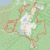
Wildcat Ridge Wildlife Management Area - Lake Telemark Loop
United States > New Jersey > Morris County > Rockaway Township > Lake Telemark > Hibernia
Distance: 18.2 Km • Elevation gain: 370 m • Maximum elevation: 287 m

Wildcat Ridge Wildlife Management Area
United States > New Jersey > Morris County > Rockaway Township > Lake Telemark > Hibernia
Description:
Distance: 12.2 Km • Elevation gain: 332 m • Maximum elevation: 322 m
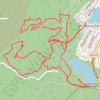
Wildcat Ridge Westie
United States > New Jersey > Morris County > Rockaway Township > Lake Telemark > Hibernia
Distance: 9.6 Km • Elevation gain: 223 m • Maximum elevation: 287 m