Import a GPX file

Banff trails

Click on a trail to view its statistics, map and profile.

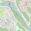
Bow Falls Viewpoint

Canada > Alberta > Banff

Bow River. Banff National Park. #Hiking #Banff

Distance: 2.7 Km • Elevation gain: 45 m • Maximum elevation: 1,388 m

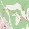
Tunnel Mountain

Canada > Alberta > Banff

Banff National Park. #Hiking #Banff

Distance: 4.5 Km • Elevation gain: 291 m • Maximum elevation: 1,685 m

Gear up for your next adventure:

📚Map Reading & Navigation Guides - Master the art of interpreting topographic contours and symbols
🔥Windproof Plasma Lighters - USB rechargeable lighters that work in high-altitude winds
📱Shockproof Phone Cases - Extra protection for your smartphone against drops on rocky terrain
🩹First Aid Kits - Emergency kits for hiking
🩹Blister Prevention Tape - Apply to friction points before they become painful sores

As an Amazon Associate, this site earns from qualifying purchases at no extra cost to you.