Import a GPX file

Aurafrède trails

Click on a trail to view its statistics, map and profile.
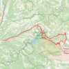
Les gorges du Verdon

France > Provence-Alpes-Côte d'Azur > Alpes-de-Haute-Provence > Gréoux-les-Bains > Aurafrède

Distance: 143.9 Km • Elevation gain: 4,060 m • Maximum elevation: 1,238 m

Gear up for your next adventure:

🏃Compression Recovery Socks - Reduce leg fatigue after heavy days of elevation gain
⌚GPS Watches - GPS watches for outdoor sports
🧊Insulated Stainless Steel Flasks - Keep water cold for 24 hours in the heat or coffee hot in the cold
🪑Portable Backpacking Chairs - A comfortable seat for studying maps at the end of the day
🗺️Topographic Maps - Detailed maps for hiking and navigation

As an Amazon Associate, this site earns from qualifying purchases at no extra cost to you.