Import a GPX file

Gréoux-les-Bains trails

Click on a trail to view its statistics, map and profile.
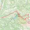
Les gorges du Verdon

France > Provence-Alpes-Côte d'Azur > Alpes-de-Haute-Provence > Gréoux-les-Bains > Aurafrède

Distance: 143.9 Km • Elevation gain: 4,060 m • Maximum elevation: 1,238 m

Other places

Gear up for your next adventure:

🗺️Topographic Maps - Detailed maps for hiking and navigation
⛺Ultralight Solo Tents - Compact shelters for multi-day topographic surveying expeditions
🍳Camping Cookware - Cookware sets for outdoor meals
🛰️Handheld GPS Units - Rugged GPS devices for tracking coordinates and elevation in the Australian bush
⌚GPS Watches - GPS watches for outdoor sports

As an Amazon Associate, this site earns from qualifying purchases at no extra cost to you.