
Nisava Administrative District trails
Click on a trail to view its statistics, map and profile.

Niševačka klisura (Niševac) - kružna tura
Serbia > Central Serbia > Nisava Administrative District > Svrljig Municipality > Nisevac
Distance: 8.0 Km • Elevation gain: 446 m • Maximum elevation: 453 m

Bojanine vode-Sokolov Kamen
Serbia > Central Serbia > Nisava Administrative District > City of Niš > Gornja Studena
Segment: 1
Distance: 12.6 Km • Elevation gain: 787 m • Maximum elevation: 1,537 m

Beloinje-Pleš
Serbia > Central Serbia > Nisava Administrative District > Svrljig Municipality > Beloinje
Distance: 13.5 Km • Elevation gain: 863 m • Maximum elevation: 1,257 m
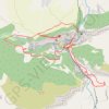
Niševačka klisura
Serbia > Central Serbia > Nisava Administrative District > Svrljig Municipality > Nisevac
Distance: 9.5 Km • Elevation gain: 404 m • Maximum elevation: 469 m

Planina Ozren od manastira Sveti Stevan u Lipovcu
Serbia > Central Serbia > Nisava Administrative District > Aleksinac Municipality > Lipovac
Distance: 15.6 Km • Elevation gain: 990 m • Maximum elevation: 1,173 m

Veliki_krcimir-litica
Serbia > Central Serbia > Nisava Administrative District > Gadzin Han Municipality > Mali Krcimir
Distance: 6.1 Km • Elevation gain: 1,123 m • Maximum elevation: 1,676 m