Import a GPX file

La Tour-de-Trême trails

Click on a trail to view its statistics, map and profile.
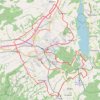
Bulle and its surrounding castles – Shortened alternative

Switzerland > Fribourg > Gruyère District > Bulle > La Tour-de-Trême

Would you like to discover the Châteaux of Bulle and Gruyères by bike ?

Distance: 32.4 Km • Elevation gain: 477 m • Maximum elevation: 874 m

Gear up for your next adventure:

🆘Personal Locator Beacons (PLB) - Satellite emergency beacons for life-saving help in areas with no mobile coverage
🧦Merino Wool Hiking Socks - Moisture-wicking socks to prevent blisters during long topographic surveys
📕Australia Maps - Maps covering Australian regions
🎧Bluetooth Outdoor Earbuds - Listen to navigation cues or podcasts during long solo treks
📷Backpack Camera Clips - Quick access to your camera while keeping your hands free for climbing

As an Amazon Associate, this site earns from qualifying purchases at no extra cost to you.