Import a GPX file

Quinte West trails

Click on a trail to view its statistics, map and profile.
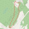
Batawa Trails

Canada > Ontario > Quinte West > Batawa

#Hiking #MTB #Snowshoeing #Loop

Distance: 3.1 Km • Elevation gain: 70 m • Maximum elevation: 153 m
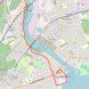
Walk - Trent River

Canada > Ontario > Quinte West

Canada, ON, Trenton Quinte West

Distance: 5.4 Km • Elevation gain: 26 m • Maximum elevation: 86 m

Other places

Gear up for your next adventure:

🧢Outdoor Sun Hats - Sun protection hats for hiking
🗺️Topographic Maps - Detailed maps for hiking and navigation
💡Collapsible Camping Lanterns - Illuminate your base camp or tent for map studying at night
⛺Ultralight Solo Tents - Compact shelters for multi-day topographic surveying expeditions
📖Australian Bush Survival Books - Local knowledge on finding water and surviving the outback

As an Amazon Associate, this site earns from qualifying purchases at no extra cost to you.