Import a GPX file

Vic-sur-Seille trails

Click on a trail to view its statistics, map and profile.
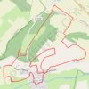
Circuit de l'ancienne route de Morville

France > Grand Est > Moselle > Vic-sur-Seille

Circuit du Bois des Loups par les Montagnes Noires et l'ancienne route de Morville avec retour par les Faluchamps.

Distance: 13.2 Km • Elevation gain: 286 m • Maximum elevation: 315 m

Gear up for your next adventure:

🦟Heavy Duty Insect Repellent - Essential protection against flies, mozzies, and march flies
📸Action Cameras - Record your journey across interesting topographic features in 4K
🥤Hydration Packs - Hydration systems for hiking
GPS Watches - GPS watches for outdoor sports
🥶Thermal Beanies - Warm hats for cold hikes

As an Amazon Associate, this site earns from qualifying purchases at no extra cost to you.