
Thaba Chweu Local Municipality trails
Click on a trail to view its statistics, map and profile.

Fanie Botha Ceylon Hut to Maritzbos Hut via Lone Creek Falls
South Africa > Mpumalanga > Ehlanzeni District Municipality > Thaba Chweu Local Municipality > Mount Anderson
Distance: 9.6 Km • Elevation gain: 438 m • Maximum elevation: 1,294 m

Fanie Botha Stables Hut to Mac Mac Hut via Mount Moodie
South Africa > Mpumalanga > Ehlanzeni District Municipality > Thaba Chweu Local Municipality > Mount Anderson
Distance: 16.5 Km • Elevation gain: 717 m • Maximum elevation: 2,058 m
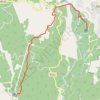
Fanie Botha Mac Mac Hut to Graskop Hut
South Africa > Mpumalanga > Ehlanzeni District Municipality > Thaba Chweu Local Municipality > Graskop
Distance: 12.6 Km • Elevation gain: 280 m • Maximum elevation: 1,635 m
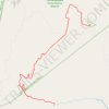
Fanie Botha Maritzbos Hut to Stables Hut
South Africa > Mpumalanga > Ehlanzeni District Municipality > Thaba Chweu Local Municipality
Distance: 12.5 Km • Elevation gain: 891 m • Maximum elevation: 1,949 m