Import a GPX file

Magdale trails

Click on a trail to view its statistics, map and profile.
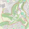
Armitage Bridge, Butternab Wood and Beaumont Park Loop Hike

United Kingdom > England > Kirklees > Armitage Bridge > Magdale

Distance: 6.7 Km • Elevation gain: 155 m • Maximum elevation: 207 m

Gear up for your next adventure:

💡Collapsible Camping Lanterns - Illuminate your base camp or tent for map studying at night
🧴Sunscreen SPF - Sun protection for outdoor activities
🥤Outdoor Water Bottles - Reusable bottles for outdoor activities
🧢Wide Brim Sun Hats - Maximum coverage for the face and neck while out in the open
🦯Adjustable Trekking Poles - Reduce impact on knees when descending steep topographic ridges

As an Amazon Associate, this site earns from qualifying purchases at no extra cost to you.