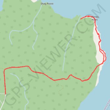
Cape Breton Island - Money Point
Gulf of Saint Lawrence. #Hiking #CapeBreton #SaintLawrence #Atlantic
- Distance: 11.3 Km
- Elevation gain: 556 m
- Maximum elevation: 378 m
- Elevation loss: 556 m
- Minimum elevation: 0 m
Interactive trail map
Trail profile
- Distance: 11.3 Km
- Elevation gain: 556 m
- Maximum elevation: 378 m
- Elevation loss: 556 m
- Minimum elevation: 0 m
About this trail
Name: Cape Breton Island - Money Point trail, distance, elevation, map, profile, GPS track
Coordinates: 47.01074 -60.42344 47.02971 -60.38728