Maxwell Falls Loop
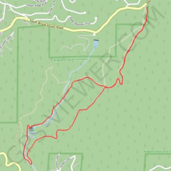
Interactive trail map
Trail profile
- Distance: 6.3 Km
- Elevation gain: 256 m
- Maximum elevation: 2,556 m
- Elevation loss: 256 m
- Minimum elevation: 2,370 m
About this trail
Name: Maxwell Falls Loop trail, distance, elevation, map, profile, GPS track
Coordinates: 39.56490 -105.37857 39.58240 -105.36077
Other hiking, mountain biking, running and outdoor activity trails
Click on a trail to view its statistics, map and profile.
Maxwell Falls Loop via Maxwell Falls Bluffs Trail in Arapaho National Forest
United States > Colorado > Jefferson County > Evergreen > Brook Forest
The Maxwell Falls Loop via the Maxwell Falls Bluffs Trail in Arapaho National Forest offers a scenic hike through dense pine forests and alongside Maxwell Creek, culminating in views of the cascading falls. The trail provides a balance of tranquil woodland paths and rugged terrain, with rocky sections that add…
Distance: 7.7 Km • Elevation gain: 327 m • Maximum elevation: 2,566 m