La Verte
- Distance: 2.9 Km
- Elevation gain: 1 m
- Maximum elevation: 409 m
- Elevation loss: 246 m
- Minimum elevation: 163 m
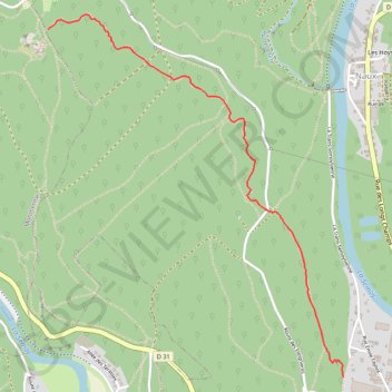
Interactive trail map
Trail profile
- Distance: 2.9 Km
- Elevation gain: 1 m
- Maximum elevation: 409 m
- Elevation loss: 246 m
- Minimum elevation: 163 m
About this trail
Name: La Verte trail, distance, elevation, map, profile, GPS track
Coordinates: 49.87563 4.78447 49.89192 4.80504
Other hiking, mountain biking, running and outdoor activity trails
Click on a trail to view its statistics, map and profile.
Eurovelo 15 - Strasbourg Rotterdam
France > Grand Est > Bas-Rhin > Strasbourg
Distance: 891.7 Km • Elevation gain: 2,104 m • Maximum elevation: 146 m