Import a GPX file

Bat Lake Trail

Algonquin Provincial Park. #Hiking #Loop #Bat #Algonquin

  • Distance: 5.6 Km
  • Elevation gain: 103 m
  • Maximum elevation: 472 m
  • Elevation loss: 103 m
  • Minimum elevation: 397 m

Interactive trail map

Trail profile

  • Distance: 5.6 Km
  • Elevation gain: 103 m
  • Maximum elevation: 472 m
  • Elevation loss: 103 m
  • Minimum elevation: 397 m

About this trail

Other hiking, mountain biking, running and outdoor activity trails

Click on a trail to view its statistics, map and profile.
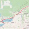
Québec - Montréal - Saint-Laurent River - Lake Ontario - Niagara Falls

Canada > Quebec > Urban agglomeration of Québec > Quebec

#Bike #Ontario

Distance: 1,078.4 Km • Elevation gain: 4,804 m • Maximum elevation: 209 m

Bat Lake

Canada > Ontario > Nipissing District > Unorganized South Nipissing

Algonquin Provincial Park. #Hiking #Loop #Algonquin

Distance: 5.5 Km • Elevation gain: 99 m • Maximum elevation: 472 m

Gear up for your next adventure:

🛰️Handheld GPS Units - Rugged GPS devices for tracking coordinates and elevation in the Australian bush
🪢550 Survival Paracord - Versatile cordage for gear repair and emergency lashing
⛺Lightweight Tents - Compact tents for backpacking
🦯Trekking Poles - Walking poles for hiking stability
🧦Hiking Socks - Comfortable socks for long hikes

As an Amazon Associate, this site earns from qualifying purchases at no extra cost to you.