Import a GPX file

Miette Hot Spring - Sulphur Mountain

Jasper National Park. #Hiking #Sulphur #Jasper

  • Distance: 8.8 Km
  • Elevation gain: 691 m
  • Maximum elevation: 2,065 m
  • Elevation loss: 676 m
  • Minimum elevation: 1,379 m

Interactive trail map

Trail profile

  • Distance: 8.8 Km
  • Elevation gain: 691 m
  • Maximum elevation: 2,065 m
  • Elevation loss: 676 m
  • Minimum elevation: 1,379 m

About this trail

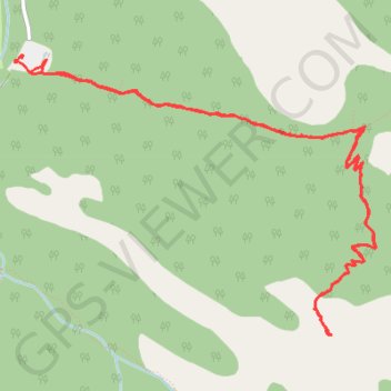
Name: Miette Hot Spring - Sulphur Mountain trail, distance, elevation, map, profile, GPS track

Start: Miette Road, Improvement District No. 12, Alberta, Canada (53.13039 -117.77172)

End: Sulphur Skyline Trail, Improvement District No. 12, Alberta, Canada (53.12948 -117.77105)

Coordinates: 53.11560 -117.77242 53.13039 -117.74070

Gear up for your next adventure:

🗺️Topographic Maps - Detailed maps for hiking and navigation
🐍Australian Snake Bite Kits - Specific pressure immobilization bandages for Australian venomous snakes
🆘Personal Locator Beacons (PLB) - Satellite emergency beacons for life-saving help in areas with no mobile coverage
🔪Outdoor Multi-tools - Versatile tools for gear repair and survival tasks in the wilderness
🧺Fast-Dry Microfiber Towels - Large towels that pack down to the size of an orange

As an Amazon Associate, this site earns from qualifying purchases at no extra cost to you.