Import a GPX file

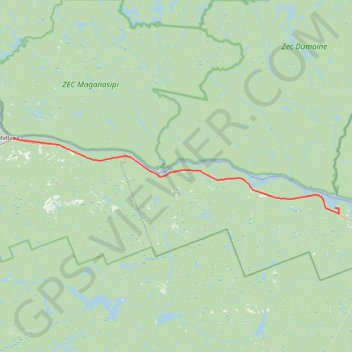
Mattawa - Stonecliffe

#Bike #Mattawa #Stonecliffe

  • Distance: 73.7 Km
  • Elevation gain: 903 m
  • Maximum elevation: 318 m
  • Elevation loss: 902 m
  • Minimum elevation: 150 m

Interactive trail map

Trail profile

  • Distance: 73.7 Km
  • Elevation gain: 903 m
  • Maximum elevation: 318 m
  • Elevation loss: 902 m
  • Minimum elevation: 150 m

About this trail

Other hiking, mountain biking, running and outdoor activity trails

Click on a trail to view its statistics, map and profile.

Québec - Montréal - Saint-Laurent River - Lake Ontario - Niagara Falls

Canada > Quebec > Urban agglomeration of Québec > Quebec

#Bike #Ontario

Distance: 1,078.4 Km • Elevation gain: 4,804 m • Maximum elevation: 209 m

North Bay - Mattawa

Canada > Ontario > Nipissing District > North Bay

#Bike #NorthBay #Mattawa

Distance: 63.4 Km • Elevation gain: 455 m • Maximum elevation: 272 m

Gear up for your next adventure:

🥶Thermal Beanies - Warm hats for cold hikes
📦Crushproof Equipment Cases - Safe transport for sensitive surveying and mapping instruments
🖼️Scratch-off Australia Map - Track the regions and peaks you have explored geographically
🌿Flora and Fauna Field Guides - Identify the plants and animals you encounter on your route
🥾Hiking Gaiters - Leg protection for trails

As an Amazon Associate, this site earns from qualifying purchases at no extra cost to you.