Sunset Peak
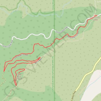
Hike from Cow Canyon Saddle to Sunset Peak by the Sunset Ridge Fire Road in the San Gabriel Mountains National Monument and the Angeles National Forest. #Hiking #Mountain #Forest #Nature #Angeles
- Distance: 5.9 Km
- Elevation gain: 525 m
- Maximum elevation: 1,760 m
- Elevation loss: 152 m
- Minimum elevation: 1,380 m
Interactive trail map
Trail profile
- Distance: 5.9 Km
- Elevation gain: 525 m
- Maximum elevation: 1,760 m
- Elevation loss: 152 m
- Minimum elevation: 1,380 m
About this trail
Name: Sunset Peak trail, distance, elevation, map, profile, GPS track
End: Sunset Ridge Fire Road, Los Angeles County, California, United States (34.21644 -117.68939)
Coordinates: 34.21405 -117.69301 34.22810 -117.67043