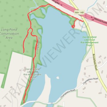
Walked Long Pond Trail in Sturbridge
Long Pond Trail, Sturbridge, Massachusetts
- Distance: 3.2 Km
- Elevation gain: 50 m
- Maximum elevation: 218 m
- Elevation loss: 43 m
- Minimum elevation: 195 m
- Moving time: 46 m 4 s
- Moving speed: 4.1 Km/h
- Maximum speed: 6.7 Km/h
- Total time: 48 m 36 s
- Global speed: 3.9 Km/h
Interactive trail map
Trail profile
- Distance: 3.2 Km
- Elevation gain: 50 m
- Maximum elevation: 218 m
- Elevation loss: 43 m
- Minimum elevation: 195 m
- Moving time: 46 m 4 s
- Moving speed: 4.1 Km/h
- Maximum speed: 6.7 Km/h
- Total time: 48 m 36 s
- Global speed: 3.9 Km/h
About this trail
Name: Walked Long Pond Trail in Sturbridge trail, distance, elevation, map, profile, GPS track
Coordinates: 42.12879 -72.13082 42.13580 -72.12507