Raven Cliff Falls
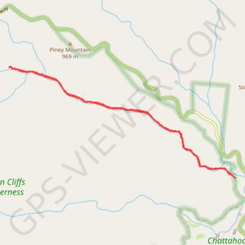
Interactive trail map
Trail profile
- Distance: 7.7 Km
- Elevation gain: 236 m
- Maximum elevation: 813 m
- Elevation loss: 236 m
- Minimum elevation: 619 m
About this trail
Name: Raven Cliff Falls trail, distance, elevation, map, profile, GPS track
Start: White Oak Gap Road, White County, Georgia, United States (34.70952 -83.78895)
End: White Oak Gap Road, White County, Georgia, United States (34.70952 -83.78895)
Coordinates: 34.70952 -83.82365 34.72347 -83.78895
Other hiking, mountain biking, running and outdoor activity trails
Click on a trail to view its statistics, map and profile.
Raven Cliff Falls via Raven Cliffs Trail
United States > Georgia > White County
The hike to Raven Cliff Falls offers a beautiful and moderately challenging trail through lush forested surroundings. Following Dodd Creek, the trail is alive with moss-covered trees, ferns, and seasonal wildflowers, making for an immersive and scenic journey toward the unique, double-streamed waterfall…
Distance: 8.0 Km • Elevation gain: 234 m • Maximum elevation: 798 m